Articles
/
Yamgorod Fortress
Yamgorod Fortress
Subject /
Architecture/Fortresses and other fortifications
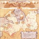
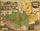
Yamgorod Fortress (Kingisepp, in the right bank of the Luga River). The Yam fortress was built in 1384 during 33 days under the direction of Novgorod posadniks. It controlled water and land passes from Novgorod to port towns of Baltic. It repelled attack of Swedes in 1395, Livonian Germans in 1397, resisted in the war with Livonians in 1443-48. In 1448 it was extended with building of the external line of the walls and adapted for using of the firearms. At the end of 15 – at the beginning of 16 centuries it was reconstruction in connection with greater resort of artillery. The new fortress had the area of 2.5 hectares and trapezium-shaped. The perimeter of the external contour was near 720 meters. There were 6 circular and at least 3 quadrangular towers on it. The walls and towers were put from the limestone and were surrounded with moat that was connected with pond. There was kremlin with two circular and two square towers at each corner inside the “big town”. The entrance to it consisted of two connected towers. There was the stone church of The Archistratigus Michael that was built at the end of 14 century (it had been until second part of 17 century). In 1581 the Yam fortress was seized by Swedes for the first time, in 1590 it was won back by Russians. In 1612 it was occupied by Swedes again. In 1682 Swedes blew up ramshackle fortifications and left only kremlin, and began to build earthworks. In 1703 Yam was seized by Russian troops, it was strengthened with earthen bastions according to design of Peter I. The stone kremlin in 1781 was demolished completely by direction of Catherine II. At present two north bastions (1703) with adjoining curtain, moats and pond which are marked outline of the fortress had been kept. The bottom parts of the stone fortifications had been kept in the earth along the considerable length. The excavations were conducted by A. N. Kirpichnikov in 1971. The parts of the kremlin walls and “big town” of 15-16 centuries, the base of template of the and of 14 century were opened. In the territory of the fortress in the building of former Yamburg commercial school there is the Kingisepp local history museum.
Authors
Plotkin, Konstantin Moiseyevich
Persons
Catherine II, Empress
Kirpichnikov, Anatoly Nikolayevich
Peter I, Emperor
Geography
Leningrad Oblast, the/Kingisepp District/Kingisepp Town
Topographical landmarks/Luga River, the
Bibliography
Кирпичников А. Н. Каменные крепости Новгородской земли. Л., 1984, С.180-209
Subject Index
Kingisepp Museum od the Local History, the
The Church of Archangel Michael at the Yamgorod Fortress
Mentioned in articles:
|
hidden
|
Archaeological monuments
Archaeological monuments of the Leningrad Oblast are settlements, grads, burial grounds, religious objects and other material trails of the past. Settling the oblast territory took place during the Mesolithic period. The age of the most ancient... more
|
|
|
|
hidden
|
Ingermanlandia
INGERMANLANDIA (Swed. Ingermanland, Rus. Izhora Land or Ingria), historic and cultural region in the western part of the Leningrad Oblast (Kingisepp, Volosovo, Lomonosov, Vsevolozhsk, Gatchina, Tosno, western part of Kirovsk Districts.) The western... more
|
|
|
|
hidden
|
Kingisepp, town
KINGISEPP, town, adm. center of Kingisepp District. Population: 50,300. It situated on the banks of the Luga River, at the St. Petersburg-Tallinn highway and the St. Petersburg-Ivangorod-Tallinn railroad. The municipal entity Kingisepp Urban... more
|
|
|
|
hidden
|
|